Sunday, October 14, 2007

Home

It’s been a long time since I stayed in a motel that used real keys.

I thought it was cold when I left Talequah before sunrise on Thursday. As I packed up the bike on Friday morning, I knew the temperature was substantially lower. I put on another shirt. When I left my home before sunrise last Sunday, it was warm enough for a t-shirt and a light denim jacket. I was actually concerned about the space my leather jacket was taking up in my pack. Now, I was kicking myself for not packing more warm clothes.

I warmed up the bike and dropped the key into the drop box at the office. It was dark. The McDonalds next to the motel was not open so I decided to head out without any coffee. I pointed the bike east and got on the road.

I had filled the bike the night before. I used the tripodometer as a fuel gauge. I reset it at each fill up and tried not to stop again until it read 100 miles. This left me with a large margin. The bike averages 140 miles per tank-full without counting the reserve.

When I was planning the trip, I was concerned about the small range of the bike. My primary worry was the availability of gas stations off the interstate. This turned out not be an issue, and the 100 mile limit proved to be just about how long I could stand being on the bike without a break.

This morning, however, I knew almost immediately that I would not make 100 miles before stopping. It was cold. I passed a bank sign with a temperature reading of 41 degrees. When I got up to highway speeds, the cold in my fingers and my face was almost unbearable. I pulled over after only 10 miles and doubled up my gloves.

When I told my son I was riding my bike 1000 miles to Oklahoma and expected it to take several days, he asked why we could make about the same distance in less than a day in our car. One reason is the bike required more than twice the fuel stops than the car. Another is the route I chose avoided interstates which resulted in a lower average speed. The biggest reason, though, is I was not overly concerned about making good time, so I would stop and explore whenever curiosity drove me. I must have turned the bike around 20 times during my trip to read a marker or look at something on the side of the road.

This morning it was the cold more than anything else that slowed my initial progress. I stopped every 20 miles or so for the first 100 for coffee and to warm up. At one point, I was honestly worried about frostbite. The cold penetrated my double gloves, my boots, my helmet, and my doubled up pants. I pressed on, however, and soon the temperature rose to a more comfortable range.

I was asked about a half dozen times this morning, by men and woman speaking with thick Tennessee drawls, if it was cold on the bike. It was the first time I noticed a thick regional accent on my trip, and it was very distinctive. I think one woman actual asked me if I was “frozed”.

If you were to request driving directions from one of the Internet map engines to go from Memphis to Chattanooga, the map engine would route you up to Nashville via 40 and down to Chattanooga via 24. I chose a more direct route from a distance perspective. I followed routes 64 and 67 all along the southern border of the state. This route was more scenic, but it also required that I ride through a dozen small towns on my way across.

The farms I passed in Tennessee seemed smaller than those I had encountered in Arkansas. I did not see any huge grain farms, but I kept passing fields and fields full of green and brown plants with white puffy pods on them. I had never seen cotton growing before. I suspected that was what it was, but I was not sure. Finally, I stopped the bike and walked into one of the fields for a closer look. The white puffy pods turned out to be cotton balls. I picked a couple and put them in my bag. I don’t know what I expected cotton to look like, but I did not expect it to look and feel just like cotton balls.

I soon noticed huge bales of cotton in fields. I did not recognize the bales at first for what they were because they were covered with orange tarps. I was only sure when I walked over and touched the layers of thick cotton under the tarp of one bale.

As I drifted closer to the Alabama border, I contemplated heading south and entering Georgia from Alabama. I chose to remain in Tennessee. My return home had followed pretty close to a Trail of Tears route called Bell’s route. I had not encountered any markers for the Trail on my return, but I knew if I dipped too far south I’d miss any that might exist.

The distance from Bolivar to Chattanooga is approximately 270 miles. It took me about 5 hours to cover it. I knew I was getting close when the billboards for Rock City and Ruby Falls began showing up everywhere. I passed a very old barn that had been painted long ago with the famous See Rock City command. The paint was so faded it was nearly impossible to read.

I took route 24 around Chattanooga and dropped down into Georgia on route 75. At Dalton, I left the Interstate for the last time and followed route 52 alternate to the Vann House state monument. The Vann house is a restored plantation home that sits at the intersection of route 52 alternate and route 225, which is the official Georgia auto route of the Trail of Tears. It is about 8 miles west of Chatworth in Springplace, Georgia which was a significant Cherokee community.

The Vann plantation was built by Chief James Vann in 1804. Chief Vann was the wealthiest planter in the Cherokee nation and possibly all of the deep south at that time. His plantation was the largest on Cherokee territory requiring up to 200 slaves to maintain. He had inns, mills, and other businesses all along the Old Federal Road in northern Georgia. He is remembered as a violent murderous man, but he was instrumental in establishing the Moravian Mission at Springplace. The mission educated many Cherokee including their leadership. Vann himself was murdered in 1809 at an Inn near my home in what is now Forsyth County.


Vann left his estate to his son Joseph who was known as Rich Joe to the Cherokee. When Cherokee land was carved up during the land lotteries of 1832, Vann’s plantation as well as the Springplace Mission were claimed by white settlers. Like the rest of the Cherokee nation, Vann and the missionaries were forced west.

After touring the Vann home, I followed route 52 into Chatworth, Georgia. I had spent the last week touring over 2000 miles of roads in the middle southwest, and I had not seen any place more scenic and quaint than this little town less than 50 miles from my home.

Chatworth sits at the foot of the Cohutta mountains. People all around refer to the range simply as the mountain. The scene created by the enormous mountain rising dramatically from the valley floor with the small 19th century town of Chatworth in the foreground is awe inspiring.

Route 52 snakes its way for 22 miles over the mountain and down into a town called Ellijay where it connects with 515. The ride can be perilous on a bike. There are many sudden turns, almost no shoulder, steep falls with no guardrails, and courtesy pull over places. No trucks are allowed over the mountain. It is all very reminiscent of roads I traveled in the Sierras out west.

I crossed the mountain with bug eyes taking in all the scenery that I did not know existed so close to my home. I observed in an earlier post that the Cherokee would have found the landscape of Northeast Oklahoma similar to Northwest Gerogia. That was before I crossed the Cohutta mountains. I saw nothing leading into or out of Talequah that compared to this.

I rolled through Ellijay at around 5:30pm. It’s another small town with its roots in the 19th century. Ellijay is most famous for it’s apple harvest and the festivals that accompany it. As I rolled through the old part of town, I noticed the businesses were all setting up for the Apple festival this weekend.

I caught 515 for my final ride home. I made it to Ball Ground by a little after 6:00pm. I actually stopped in the town center area and read the historical marker that I had passed several times before and never read. The marker indicated, that in addition to being the site of the Cherokee game I watched reenacted in Talequah, it was the site of the decisive battle in the Cherokee – Creek war. The battle, known as Tali’wa took place in 1755, and the Cherokee victory drove the Creek from North Georgia forever. It seems oddly iroinc to me that the main thoroughfare through the Cherokee nation capitol of Talequah is actucally the Creek word for themselves: Muskogee.

With the last marker read on this journey, I raced the remaining 15 miles home over familiar roads. A quick odometer check in my driveway showed I had traveled over 2270 miles since I left on Sunday morning.
Saturday, October 13, 2007

Talequah to Memphis


It was still dark and cold when I left Talequah on Thursday morning. I followed route 62 east for a little over 25 miles. The tank bag I lost Monday had a nice clear map pocket on top. For most of the trip to Oklahoma, I was able to refer to the map in the pocket as I rode. Now, when I needed to check the map, I had to stop.

I pulled into a small convenience store for direction. I was looking for Arkansas 59. The guy behind the counter was friendly and he gave me detailed directions; twice. Of course, the human short-term memory buffer is pretty small. Most people are only able to remember 7 things they just hear plus or minus 2. This is why telephone numbers are 7 digits long. I’m no exception. After leaving the store, I was pretty much lost after step 5.

I found myself hurling down a country road at sunrise hoping I was heading toward Arkansas. I rode deeper and deeper into rural northeast Oklahoma when I started to notice lose dogs at the end of the drives I was passing. During my journey, I’ve compiled a list of things to avoid on a motorcycle. On the list are things like: on-rushing semis on small country two lane roads, extremely narrow and high bridges, thunderstorms, bridges with holes in them, and now -- dogs.

Dogs are a big problem on bikes. They chase them. Sometimes, they try to bite the rider. They can even get caught up under the wheels and cause a wreck. As the sun was coming up over the small homes, trailers, and little farms, I was racing from one collection of barking, chasing dogs to another. To make matters worse, I did this for 5 miles before I realized I was not heading toward Arkansas. I had to turn around. All those dogs I surprised on the way in, were ready for me on the way out. I didn’t get bit, and I did not dump the bike, but it sure was close.

After twice running the canine gauntlet, I found the road the convenience store guy had directed me to. Soon, I was winding east through the Ozarks I had missed in Missouri. Before this trip, the only thing I knew about Arkansas was it was the home of former president Clinton. Now, I know it is an incredibly scenic country with beautiful mountain views and expansive farm fields. I guess they don’t call it the Natural State for nothing.

I followed route 22 out of Fort Smith until I hit route 64 and bypassed Little Rock. It was a 300 mile ride from one end of Arkansas to the other. I stopped several times for fuel and to stretch my legs. I was closing in on the Mississippi by noon.

The last 75 miles in Arkansas was nothing but huge grain and soybean farms. I had been passing farms and ranches all morning, but it was not until I entered the river basin that the landscape flattened out and filled with countless acres of big agriculture. Huge grain harvesters were in the fields filling tracker trailer rigs with their reaping. There were so many of them going at once that the air was filled with a yellow grain haze. I could taste it as I flew over the roads.

I am relatively new to motorcycling, and I am still amazed at how different traveling by bike is than by car. In a car, this scene would not have had nearly the impact on me. It would have been smaller framed by the windshield, there would have been no tactile sense of road rushing beneath, and there would have been no wind with grain dust in it. In a car, I would have been listening to the radio or talking to a passenger. I would not have been as alert to the road or to all the activity occurring on either side of it. If I had been a passenger, I may have even been asleep, but on the bike, I experienced everything.

In the distance I noticed what I though was a forest fire burning. It was definitely a fire, and by the size of the cloud of smoke, I figured it was large. There was a stiff cross wind blowing across the fields. The air was yellow with grain, and the white and brown plume of smoke was growing on the horizon. Soon, I noticed more columns of smoke rising from several distant points. I became concerned that I was rushing into a massive windswept fire, but all these farmers were working around me like nothing was going on.

I started to pass occasional fields that were barren and lunar gray, and then it dawned on me that the fires were intentional. A quick check of google later (I love the Internet) confirmed my hypothesis. The farmers were burning the left over straw from the grain harvest to prepare for reseeding in the spring.

All too soon, my idyllic romp through the farms of northern Arkansas was brought to an abrupt end when I entered the city of West Memphis. I moved from mega farms to mega city in the blink of an eye. Once again, I was surrounded by killer semis as I vied for my piece of asphalt on a congested Interstate crossing over the Mississippi.

Once on route 40, I started seeing signs for Graceland. I thought it would be cool to visit the home of Elvis. I had made good time. It was only a little after 1:00. I followed the signs to the Memphis beltway, 540, and that’s when I became less concerned with finding the King, and more with staying alive. I’ve mentioned in previous posts the extreme effect the wind from rushing semis has on the bike. I cannot understate how scary the effect can be in close quarters like on a tightly packed, yet swiftly moving, interstate highway. Route 540 is a genuine 6 lane superhighway. I found myself more than once boxed in by semis in the lanes to my left and right and in front and rear. I gave up on the King, got lost, and ended up at the airport.

By that time, I needed a break from the highway. I consulted my growing collection of road maps, and discovered the same route 64 that I had followed in Arkansas also traversed Tennessee. It took a few tries, but I left the Memphis 540 orbit and resumed my eastern trek on route 64.

It took a considerable amount of time to travel the first 25 miles out of Memphis. Unlike its unrestricted counter part in Arkansas, the western portion of Tennessee route 64 meanders through malls and small town centers each with a half a dozen traffic lights. The sun was falling fast behind me. The towns were growing increasingly smaller with fewer hotel options when I decided to stop for the night at place a called Bolivar.

I had traveled nearly 440 miles since leaving my hotel in Talequah that morning. I was tired and ready for a hot shower and a walk or a run. I cruised through the town looking for a brand named hotel; finding none, I settled on the first one with Internet and cable. It was two steps down from the Days Inn I raced the Thunderstorm to in Missouri on Monday night, but it was cheap, and clean.

The owner of the motel was a nice, albeit incomprehensible, Indian gentlemen. He was quite taken by my bike, and told me it seemed big to him. He said the people where he was from all rode much smaller bikes because of high fuel costs. After being buffeted by semi blasts and straw fire cross winds for the past 14 hours, I told him I could not imagine making the trip I was on with anything smaller.


We bid each other good night, at least I think so.

Thursday, October 11, 2007

Studying Talequah

I spent Wednesday wandering around Talequah both on foot and on the bike.

My main goal for traveling to Talequah was to lean about the town first hand so I could write credibly about it. I set out early from my hotel with a list of places I wanted to visit. My first stop was a small park I spotted on my way in the night before.

The park, I discovered, is called Cherokee Square, and it surrounds a large red brick civil war era structure that was once the Cherokee Nation capitol building. Today, the building houses the judiciary branch of the Cherokee Nation

There are several monuments in the park. The most prominent one is dedicated to confederate war dead. The Cherokee were primarily an ally of the confederacy during the civil war, although, there were attempts by Chief John Ross to maintain neutrality.

My favorite monument, however, memorializes the first phone call that was placed west of the Mississippi. That call was made from Talequah in 1885. It just seemed a little quirky and out of place amoung all the other more solemn items.

I visited the Cherokee museum and heritage center. Inside the museum is an excellent exhibit that depicts events from before the Trail of Tears until Oklahoma statehood. Outside there is a guided walking tour of a simulated ancient Indian village. I shared the walking tour with a group of high school students on a field trip. One of the demonstration stops on the tour has Cherokee reanactors playing the Cherokee ball game. They gave the group of high school kids sticks and turned them lose to act as Cherokee players.


The Cherokee played the ball game for a variety of reasons including to resolve disputes between tribes. The game was significant enough that Cherokee would travel many miles to meet in central places to play. I live in Ball Ground Georgia. It’s called Ball Ground because it was where the Cherokee in northwest Georgia would meet to play the game.

I was able to make a contact at the Heritage center who I can exchange emails with if I have questions about the Cherokee.

After I left the museum, I followed signs toward the Ross cemetery. So much of the history I have been tracing involves John Ross that I thought it would be good to go see his grave. The area outside of Talequah is very rural. Many roads are in rough or even unpaved condition. Unfortunately, for me to get to the Ross grave I would have to cross a bridge that I could not cross safely on my bike. The wooden decking of the bridge was rotted through in many places. I did not want to see the grave that bad.


I spent most of the rest of the day in the library. I could not help but notice, that a few homeless, definitely psychotic, people were spending the day in the library too. It was apparent that these folks were regulars by the way the staff interacted with them. I, on the hand, was somewhat unnerved when a man approached me and recited a mantra he must have memorized over the years explaining how grateful he was to have lived through the end of the 20th century. I quickly learned that anyone who remotely glanced at this man would be met with the same recital. The staff called him John. I watched john deliver his speech over and over again through the afternoon. I think I may have it memorized.

I wanted to ensure I established some contacts before I left. After John delivered his last speech to the woman at the reference desk, I struck up a conversation that ultimately lead to me explaining that I had ridden my motorcycle 1200 miles to research the town for a book I would like to write. As soon as I finished telling my story, I realized that I must sound as nuts as John. Thank god I showered and shaved before going to the library. I have no doubt the woman thought I was off my meds, but at least I was clean. What ever the reason, she did not dismiss me pleasantly like I watched her do to John 5 or 6 times. She gave me her email address, I’m betting it’s the same one she gives John.

I ended the day riding from one end of the town to the other taking pictures and notes. I’m a little surprised I was not arrested. In the post 911 day. I’m not sure how one explains why they are taking pictures of police departments, hospitals, and other seemingly uninteresting subjects.

Tomorrow I start home...

Wednesday, October 10, 2007

What an itch!

Unfortunately, I did not have Internet Connectivity last night, and I could not post.

It's funny, I always assumed when a hotel desk person said they had Internet access, that meant the hotel guests too. Apparently, it only applies to the desk girl playing Internet Poker at the place I'm staying.

I left my hotel in Missouri at 6:30am on Tuesday morning and headed west into the Ozarks. I had been wondering if it was overkill to pack my heavy leather jacket. Yesterday morning the wisdom of my choice was confirmed. It was cold when I started out. The roads were empty, and except for 2 or 3 fuel stops, I raced away from the sunrise at over 80 miles an hour for nearly 3 hours. Even with the thick leather jacket over a sweater, I was shivering.

I had looked forward to riding through the Ozarks on route 60. I had imagined a scenic winding ride through high mountains with trees full of autumn colors. Instead, I found the route to be a long gradually ungilating trek through uninteresting landscape. The route was efficient, but not exceptionally pretty. I was spoiled in Tennessee by the dramatic mountain views. On route 60, I was constantly teased by signs for towns like Mountain View, Mountain Grove, and Mountain Home, but as I passed each of these exits I found myself wondering where the mountain was. I believe the portion of the Ozarks I traveled through is more of a plateau than a collection of hills to climb over and wind around.

As I neared Springfield, I felt an itching sensation building in my scalp. With helmet firmly in place, and the road rushing by, I found myself with the proverbial unscratchable itch. I have a relatively high threshold for discomfort. This is evident by my current 2000 mile journey on a motorcycle seat that many would find painful on trips to the local grocery store. The itching sensation quickly became unbearable, however, and I was forced to stop at the next gas station.

There I was, 30 miles out from Springfield Missouri, with a dehabilitating case of Helmet Itch. I did not even know there was such a thing as Helmet Itch. Well, there is, and I had it so bad I could not wear my helmet. At the first station I pulled into, I bought a baseball cap thinking I was having some kind of reaction to the foam liner in the helmet. Of course, I discovered after getting back out on the highway that the cap did nothing to stop the itching. At the next station, hoping for a different result, I bought a bandana. At the next station I took the liner out of the helmet and stuffed it into my bag. That effectively rendered the helmet useless because it no longer fit my head. It took me two hours to traverse the 30 miles into Springfield.

In Springfield, madly scratching my head, I rushed to the nearest pharmacy. I told the guy behind the counter my problem. He was very helpful, but not at all discrete. He called over a female coworker, who he explained rode motorcycles all the time and would be familiar with the problem. Before I knew what was happening, I was caught up in a parade of drug store employees who were all discussing remedies to my scalp affliction while we snaked up and down the aisles. The parade stopped in front of something called Scalpicin.

I would have tried anything. At that point, I was seriously considering shaving my head – seriously. Needless to say, I did not pay much attention to the dosage instructions. I covered my head with the stuff. I decided to give my scalp a rest from the helmet so I made my way to a civil war battlefield near by where I could wander around helmetless and wreaking of Scalpicin.

The civil war in Missouri was mostly a guerilla event with extremist on both sides preying on civilians. There was, however, at least one large battle fought there, and I had the fortune of stumbling on the battlefield park when I needed a break from the bike. The battle was fought at a place called Wilson’s Creek, and the battlefield park is appropriately named, Wilson’s Creek battlefield,

It was late in the afternoon when, after repeated dousing of Scalpicin, I got back on the road toward Oklahoma. For the first half of the day, the sun was at my back and I had mused that I was racing away from it. When I left Wilson’s Creek, the sun was high over head and beginning to make it’s decent into the west. I had made so much progress during the first few hours of the day, I was sure I would make it to Oklahoma by early afternoon, but after leaving Wilson’s Creek, I was not sure I would make it to Oklahoma on Tuesday at all.

I had the itching under control, and as I drew closer to the Arkansas border, I began to notice Trail of Tears route marker signs popping up. These were the first official markings of the trail I had seen since Hopkinsville. My spirits rose.

The sun that I raced from in Missouri was now ahead of me in Arkansas. I was heading due west, and my darkened sun visor barley kept the rays from blinding me. The bland landscape of the Ozark plateau was replaced by huge farms and ranches. Most of the fields appeared to be already harvested, but some were filled with countless dozens of acres of short yellow leafy plants that I believe were soy beans.

Following the Trail of Tears markers kept me true to the purpose of the ride, but added many miles. At one point, lured by a historical marker sign, as I am by all, like a moth to a porch light, I pulled off the road in Arkansas about 30 miles from the Oklahoma state line. After examining a curious combination marker that memorialized several migrations through the area, including the trail of tears, I asked a nearby store clerk how much further it was too Oklahoma. She was generally amused that I was on those roads heading for Oklahoma, and even though she lived in the area, she was not sure I could reach Oklahoma the way I was going. When I told her I was following the Trail of Tears markers, she made it clear the route I was on was the long way.

With the sun sinking fast, I finally reached the Oklahoma line. I had traveled over 1100 miles since I left my home on Sunday morning. I was still 40 miles from Talequah, and I was not sure I would make it before dark, but I had accomplished one of my goals in following the Cherokee Trail of Tears all the way from its most eastern point to its end.

Much of the last 40 miles to Talequah ran through very remote back roads that twisted and turned through a surprisingly hilly and wooded landscape. I had imagined Oklahoma to be flat and brown. Instead, this area is very similar to northwest Georgia. The Cherokee who made it hear in 1839 may have drawn some comfort in that familiarity,

I checked in to my hotel at 7:30pm. I had been on the road for over 13 hours.

Since I’m posting this late, tomorrow is really today, and I know how it ends. I don’t have the energy to write another entry tonight so I will remain a day behind in my posts.

I begin the long road back home tomorrow (Thursday).

Monday, October 8, 2007

Bridges, Semis, and Thunderstorms...

I'm writing today's entry only 220 miles west of where I wrote yesterday's.

I had planned to be in Springfield, Missouri tonight, but instead, I am over 200 miles east in a Days Inn I raced to while fleeing an oncoming thunderstorm. I'm not even sure what town I'm in.

I got a late start leaving Hopkinsville this morning because I took a long run and did some exploring. I went back to the Trail of Tears park, and I spent some time walking and reading the plaques. There's a cemetery in the park where 2 Cherokee chiefs are buried who died during the encampment there. Their names were Fly Smith and Whitepath. The plaques in the park state that Whitepath was a famous Cherokee war chief who disagreed with the passive position the Cherokee took during the years leading to the removal. There are statues of the chiefs. Whitepath's statue is shown standing looking skyward. He has both arms at his side, but one hand is open in a question, and the other hand is clenched in frustration. It's a very moving piece.

I left Hopkinsville at around 11:00. I avoided the interstates entirely today and paid a price in miles. I rolled through western Kentucky along back roads and watched acres and acres of harvested corn and grain fields race by me. The landscape along state route 80 west is punctuated by super sized grain storage sheds and tractor dealership.

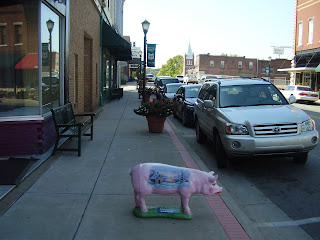
I stopped briefly in Cadiz to walk thru a couple of the antique shops and look at the Indian artifacts they had. I did not intend to stop, but as I was approaching the town center, I noticed many of the shops and public buildings along the road all had decorated hog statues placed out front. The statues were all the same size and appeared to be the same pig, but each was decorated in a unique theme chosen by the owner. When I reached the town center, I found the main street was lined with banners advertising the Trib County Ham Fest which takes place next weekend. I stopped to get a closer look at a few of the painted porkers and wandered in some of the shops.

When I left Cadiz, I raced toward a collection of state parks known as the Land Between the Lakes. As the name indicates, there are two large man made lakes near Cadiz that divide the area. Much to my dismay, I discovered the bridges that crossed those lakes were very high and very narrow. I was exceedingly uncomfortable navigating the bike over them. The fear factor rose considerably whenever an on coming semi would pass me on those bridges. Unfortunately I discovered later, the same long, high, thin bridge design was used to span the Mississippi and Ohio rivers too.

My next stop was another small town called Mayfield near the western border of Kentucky. Here, I found the small mom and pop restaurants I declared dead yesterday were still alive and thriving. I passed an ice cream stand that looked like it was in operation since 1950. It was located at the end of an airport runway and it did not have the name Dairy Queen, Brewsters, or Ben and Jerry’s anywhere on it. I also passed two or three small restaurants that had signs out front declaring their specialty was catfish. I chose to have lunch at a placed called Carr's Bar BQ Barn.

Carr's is on the main drag in the "historical" city layout portion of Mayfield. Almost every town in America that existed before strip malls and interstates has a city block that was designed for pedestrian window shopping. Most towns are rediscovering the value of these areas and renovating them. Mayfield is no exception. Many of the storefronts in the historical portion are empty, but they all look recently restored. Hopefully, they will be occupied soon.

Carr's is in a long narrow red building with empty lots on either side. A man I spoke to in the parking lot told me there once were large buildings on either side of Carr's which explains the long narrow design. He also said the place was called the Hole In The Wall then, and it had been in business for 50 years. I was attracted to Carr's because of the smell. On a bike, not only can you see more than from within a car, you can smell more too. This is not always a good thing, but in this case it was.

Inside, Carr's looks its age, and so did it's patrons. I'm guessing mostly long time regulars eat at Carr's because when I walked in every grey haired head seated at the lunch counter turned in unison to stare at me. I chose the open stool closest to the door. I quickly noticed that none of the other customers appeared to be younger than 60, and many of them were practicing the dieing art of eating and smoking at the same time.

Before I could change my mind and make a retreat, a woman behind the counter asked me what I would like. I asked for a menu, and with a shake of her head she told me she did not use them. I glanced around for a board or sign that listed what was available and found none.

I said, how do I know what you have? She said, we have the usual stuff. You know, she said, burgers and barbeque. Once upon a time this probably made perfect sense, but I have spent the last 25 years eating in places where every detail of food propriety has been carefully planned by corporate franchise menu specialists. I did not even know how to ask for something that did not appear on a laminated menu. She told me the pulled pork platter was good. She was right. I wolfed it down without even noticing the cigarette smoke wafting through the air. I'm fairly sure she made the price up on the spot too, but it was more than reasonable. If you're ever in Mayfield, stop at Carr's.

From there, I made a run for the Mississippi. I got lost twice which is very easy to do since some of the route numbers don't match what Google maps says, and some roads just end even though Google maps indicate otherwise.

While making my way to Wickliffe to view the Indian Mounds there, I was almost blown off the road by an on-rushing semi. The wind blast ripped my tank bag off the bike and hurled it into the road. Unfortunately, before I could retrieve it, a guy driving a big camper ran over it. I looked him in the eye just before he hit my bag, that I was vigorously gesturing for him to avoid, and I swear he was smiling; some people are just evil.

After I collected the remains of my bag and its contents, I made my way to the Indian Mound park only to find it closed. The day was going down hill fast.

I briefly stopped at a small park at the confluence of the Ohio and Mississippi rivers where Louis and Clark camped while learning how to determine latitude and longitude.

I had planned to go up to Cape Girardeau and visit a large Trail of Tears park located where the Cherokee crossed the Mississippi. It was already 3:30, however, and after finding the Indian Mound park closed I decided not to risk riding to another park without knowing for certain that it would be open.

As I continued my trek west toward Springfield, I noticed the sky darkening. There are many things to avoid on a motorcycle, but near the top of the list is a thunderstorm on a back road in Missouri with no shelter. I loitered about a truck stop for a while trying to decide if I should wait for the coming storm to pass or chance more time on the road.

I had not made hotel arrangements for the night. My plan was to price shop a few hotels in one of the small towns I rode through. Instead, I looked at the map and picked what I thought was a good terminus for today. I chose a place called Poplar Bluff. On the map, it looks to be about halfway from the Mississippi to Springfield. When I called the Comfort Inn there, the woman who answered informed me they were in the middle of a violent thunderstorm. I made another plan.

The people at the truck stop told me there were hotels 15 miles west so, after checking the sky a few more times, I nervously set out in search of a place to stay. I quickly regretted that decision when, almost immediately, I was forced to race a lightning spewing monster black cloud to my present location.

I’m done for the day.

Sunday, October 7, 2007

First Leg

I'm writing this from my hotel room in Hopkinsville, Kentucky. The locals call this place Hop Town. As far as I can tell, there's not a lot of hopping going on around here. It's a nice enough town. It has the usual collection of WalMarts, Starbucks, and other chain names. It's kind’a spooky how similar all American towns are beginning to look. I used to think that was comforting. Now, I'm not too sure I like it. I think the mom and pop stores of the past seemed more authentic. The chains are all copies of someone's idea of what a good restaurant or store should be, but they all feel a little fake.

On a bike you see so much more than you do from inside a car. As I raced across Georgia and Tennessee on back roads and interstates I was often struck by how beautiful the countryside is, and ,I could not help but notice a disturbing trend in all of the towns I rode through. Worse than the chain store sameness is the proliferation of pawn shops, title loan brokers, and pay day loan offices I saw. I could not keep count of the number of these establishments I encountered in every town I rode through from Canton Georgia to Hopkinsville Kentucky. That there is such a large market for these places speaks volumes about the real state of our economy and how close we may very well be to the economic abyss.

Hop Town does have at least two things that most other towns do not. First, they quarry limestone or chalk here and many of the roads leading into town are covered with it. Second, they have a Trail Of Tears commemorative park. The area was used as a large encampment for the northern arc of the Trail of Tears. In addition to some recreated log buildings and other educational displays, the graves of two Cherokee chiefs are located in the park.


I arrived too late to visit the park tonight. I will tour the park tomorrow morning.

I am exhausted. I put over 500 miles on the bike today through some beautiful scenery and challenging roads.

I left the house at 5:30am and I got settled in the hotel here around 6:30pm central time.


This morning, I began by riding state route 20 west through Cherokee county, Georgia and then 75 north to Chattanooga, Tennessee. There, I stopped at Ross' Landing to view the removal detachment's jumping off place for the west. After that, I headed a little south of Chattanooga to a place called Rossville where I visited the home site of Principle Chief John Ross.


John Ross is thought of as the Cherokee's greatest chief. This is somewhat ironic since he was only 1/8th Cherokee. As his name suggests, he was mostly Scottish. Before he was a chief, Ross was a soldier who organized and lead Cherokee regiments in battles during the war of 1812. He was an ally, and subordinate, of Andrew Jackson. Ross tried to use his standing with Jackson and his knowledge of the law to prevent the Cherokee removal. When he failed to prevent the removal, he lead the Cherokee into exile.

Ross's log home is on a fenced in lot inside a small run down park behind the Rossville post office. If you blink as you go through Rossville, you will miss the signs that leads you to the park.


From Rossville, I rode out to route 127 and climbed up into the Cumberland Mountains to a town called Signal Mountain. Signal Mountain takes it name from the signal station the Union army setup there during the Civil War. I visited the signal station. It is now a state park. The view from the station is incredible. After surveying the landscape and seeing how steep many of the mountain sides are, I cannot imagine how difficult it must have been to move thousands of people through the Cumberland range.


I followed 127 on a winding course through the mountains. At one point, against all better judgment, I pulled the bike into a graveled area to look at what appeared to be abandoned tunnels cut into the cliff face. There were 2 large rectangular openings cut into the side of the mountain. The openings were at least 12 feet high by 10 feet wide. They had to be more than 75 years old. My guess is they are mining or railroad artifacts. I would very much like to know for a fact what they are. I was too chicken to go in or even get very close to the openings so I cannot be sure how far into the mountain they go. I suspect they go very deep.

My next stop was at Shellford Baptist Church outside of McMinnville Tennessee. A church has been on or near the same place since the Shell Family donated the land in 1815. Cherokee following the northern route passed by the church property. According to legend, a Cherokee preacher held services on the site and at least one Cherokee girl is buried in the cemetery. Unfortunately, the cemetery contains at least 1000 markers. Many of them are from the first half of the 19th century. I could not find the grave of the Cherokee girl said to be buried there.

After Shellford, I rode to the Hermitage. The Hermitage is the name Andrew Jackson gave to his plantation. No Trail of Tears ride would be complete without a visit to the homesite of the architect of 19th century Indian removal policy. It is now a park just east of Nashville.

I had to take route 40 toward Nashville to get there. I am extremely glad today is Sunday. Route 40 was scary enough on the bike in Sunday traffic. You have not known terror until you've had to cross over 4 lanes of crowded traffic on a motorcycle at speeds in excess of 80 miles per hour to exit from the left side of the highway. Why do they have exits on the left side of highways? Don't road planners know that territory is reserved for the most aggressive, turf conscious drivers.

The mansion at the Hermitage has been restored to near perfect condition. For a $15 fee, the people who run the park will provide you with guided and unguided tours of the mansion and the surrounding garden and arboretum. Jackson was an extremely effective general and president. He was also a large slaveholder, he probably held more slaves than any other American president. Like most most men of his time, he did not view subjectation of people by race as a moral issue. The same norms that supported african slavery also allowed for dehuanization of indigenous populations. Jackson saw no wrong iin his actions, and niether did the majority of his contemporaries.

By the fall of 1838, Jackson had left the white house and returned to the newly remodeled Hermitage. While he was there, thousands of Cherokee people would have passed within a day's ride of the mansion on their way to Oklahoma.

I’m too tired to write anymore. I hope tomorrow to figure out how to get video up . My current problem is the video camera I have records on mini discs, and my MAC does not read mini discs…

Friday, October 5, 2007

The Roundup

I have not been able to update the blog lately because I've been away on business.
I'm actually in Boston. I fly home tomorrow morning.

Tomorrow I will pack up the bike, board my dog, and prepare to get on the road.

It's time to write some on how the Cherokee prepared for their Journey.

The removal came with substational warning and no warning at the same time. In 1807, Georgia exacted a promise from the Federal Government, then lead by President Thomas Jefferson, to remove all of the Indians from within its territory in exchange for Georgia giving up its claim on land that would become the states of Alabama, Arkansas, and Mississippi. It took the Federal Government 31 years to make good on it's promise.

For a time, the Cherokee believed they could convince Georgia and the United States that they were a civilized people who's sovereignty and property rights had to be respected. They knew they were vastly outnumbered and posed no military threat, but they believed if they adopted a constitutional government and became more European in their lifestyles they would be allowed to remain a nation. They even won a case in the Supreme Court upholding their sovereignty, but it was not to be.

In 1830, the U.S. Congress passed the Indian Removal act. The law granted Andrew Jackson the authority to negotiate treaties with the civilized tribes of the east for the the removal of all Indians living within the borders of the United States to land west of the Mississippi.

In 1835 a small group of Cherokee , without the consent of the official Cherokee government, signed the Treaty of New Echota. The treaty surrendered all Cherokee lands east of the Mississippi to the United States in exchanged for $5 million dollars and new territory in what is now Oklahoma.

The official Cherokee government, under the leadership of Chief John Ross, asked the United States Senate to reject the treaty on the grounds that it was illegal and did not represent the wishes of the Cherokee people. John Ross travelled to Washington in person and presented petitions signed by 15,000 Cherokee to Congress pleading for the rejection of the treaty. Despite the illegitimacy of the treaty, and the appeals by the Cherokee people, the Senate ratified the treaty of New Echota in 1836 by a single vote.

The terms of the treaty gave the Cherokee two years to relocate themselves to the lands west of the Mississippi or face forced removal by the United States Army. Very few Cherokee complied with the treaty and moved themselves. There are multiple theories in the histories of the removal as to why so many Cherokee ignored the treaty. One theory is the Cherokee were just not informed by their leadership. Another theory suggests the Cherokee did not believe they would be forced from their land. What ever the reasons, two years passed and the Cherokee did not prepare and did not move.

In the Spring of 1838, then president, Martin Van Buren commanded general Winfield Scott to use the United States Army to remove the Cherokee people from Georgia and transport them to Oklahoma.

On May 10th, 1838, General Scott issued a proclamation to the Cherokee People stating his plan for removal.

Cherokees! The President of the United States has sent me with a powerful army, to cause you, in obedience to the treaty of 1835 to join that part of your people who have already established in prosperity on the other side of the Mississippi. Unhappily, the two years which were allowed for the purpose, you have suffered to pass away without following, and without making any preparation to follow; and now, or by the time that this solemn address shall reach your distant settlements, the emigration must be commenced in haste, but I hope without disorder. I have no power, by granting a farther delay, to correct the error that you have committed. The full moon of May is already on the wane; and before another shall have passed away, every Cherokee man, woman and child in those states must be in motion to join their brethren in the far West.

Unlike the Cherokee, Scott did prepare for the removal. Prior to issuing his proclamation, Scott had his soldiers construct concentration camps, known as removal forts, near the Cherokee villages and population pockets. After he issued his proclamation, Scott made good on it's words by immediately rounding up all the Cherokee and holding them in the removal forts for deportation west.

For years, the Cherokee had apparently ignored all the signs and outright warnings of their impending removal. Just like an earthquake is the sudden release of long accumulating tectonic pressures, the removal events, that had taken years to build, exploded overnight. Once Scott issued his proclamation, United States soldiers and Georgia Millitia fanned out over the Cherokee villages and dragged men women and children off to the concentration camps. All the histories indicate the roundup was sudden, harsh, and cruel. The Cherokee's time ran out, and no more was granted for packing and preparing. The Cherokee took to the concentration camps only what they could quickly gather when the soldiers appeared at their door.

Fort Scudder or Frogtown was a fort that stood on land belonging to Jacob Scudder during the time of the removal. Although no one knows for sure exactly where Fort Scudder was, it is highly likely that it was within walking distance of my home. Though not documented anywhere, it is also likely that Camp Gilmer was used as the removal fort for the Frogtown/Hightower Cherokee community.

It is the Hightower community that I am interested in learning most about.

Monday, October 1, 2007

The Outbound Route

The Trail of Tears was not a single route. The term "Trail of Tears" has been applied to the forced migration routes for many of the eastern and mid-western indigenous peoples. Even the Cherokee's route from Georgia was not a single trail. There were 4 primary routes used to move the Cherokee from the Cherokee Nation to Oklahoma. Three of the routes were land routes and one was a water route.


The water route was used by a few Cherokee detachments who boarded boats on the Tennessee, Mississippi, and Arkansas rivers. The route was extremely difficult and impractical due to low water levels.

The three land routes were the Northern, Bell, and Benge routes. The Bell and Benge routes are named after the military commanders who lead the detachments. The Bell route was the shortest route following the most direct line from Chattanooga, TN to Tahlequah, OK. The Benge and Northern Routes followed a northern arc across Kentucky and Missouri. The detachments chose different routes depending on the road conditions, reliable river crossings, and availability of forage.

The Northern route proved to be the most difficult of the 4 paths. The Northern route detachments could not leave Chattanooga until August due to a severe summer draught. Once on the road, they found heavy fall rains had made the roads nearly impassable. The march took more than 7 months to complete.

Only the Northern route can be closely followed by modern roads. My plan is to follow it to Oklahoma as closely as I can. It took the Cherokee 7 months to complete the passage by wagon and foot. I hope to complete the ride in just over 2 days.


View Larger Map
My plan is to divide the ride out across 3 legs. I will need to stop every 100 miles for fuel. Additionally, I plan on stopping at various interest points along the way. The limited range of my bike is the source of most of my current anxiety. My route will avoid major highways for large distances. I will need to keep a constant eye on my fuel consumption.

The first leg will take me 304 miles from my home in Cumming Georgia to Hopkinsville Kentucky. I plan to make at least 3 interest stops on the first leg. I will stop at the Cherokee departure point outside of Chattonooga, the Shelford Baptist Church in McMinnvile to view some Cherokee graves, and if possible, the Hermitage outside of Nashville. In order to accomplish all of this during day light, I plan on leaving my home at 5:30am on Sunday, and hope to arrive in Chattonooga by 8:00am.

The Hermitage was the home of Andrew Jackson. Jackson was a veteran of many battles with the Creek and other indigenous tribes. The Cherokee were an ally of Jackson's during the battle of Horseshoe Bend which was Jackson's most famous victory over the Creek Indians. Despite this, Jackson was a strong advocate for Cherokee removal, and it was during his presidency the removal process was executed. Jackson is reviled in post removal Cherokee culture.

My second leg will take me out of Kentucky, over a small portion of Illinois and across the entire southern half of Missouri through the Ozark mountains. My plan is to spend the night in Springfield Missouri, but this leg will be over 350 miles long. I am concerned I will not to be able to complete it in day light. I don't want to ride at night, so I may need to alter my destination point. I hope to stop at a Trail of Tears park near Cape Girardeau on the Mississippi river.

The last leg will take me down out of Missouri and into Oklahoma. This will be my shortest leg. It will be approximately 170 miles. My plan is to arrive early enough in Tahlequa on Tuesday morning to visit the Cherokee Information and Cultural Center. After that, I intend on moving on to the Tulsa area to begin my research.
Saturday, September 29, 2007

Talonega

My research took me back into the town of Dahlonega today. Dahlonega is a 15 mile ride from my house along some of Georgia’s most beautiful winding roads. I put over 100 miles on the bike today. I can’t help but think what a small amount that really is compared to what I will be doing next week.

The town of Dahlonega plays a large role in the story I’m writing. More specifically, the Federal mint that was located in Dahlonega from 1835 until it burned down in 1871 and the coins produced by that mint in 1838 play a large role in my story. Dahlonega is very significant in the Tragedy of the Cherokee removal.

In 1828 Benjamin Parks discovered gold while deer hunting in a place that was then called Licklog Georgia. The legend says Parks literally tripped over a large piece of quartz laced with the yellow metal. The Cherokee called the metal Talonega. Within months, word of Benjamin's discovery had spread worldwide and the 1829 Georgia Gold Rush was on. The town of Licklog was renamed Dahlonega which was the English spelling for the Cherokee pronunciation of Tah-Lon-Ega, and a new reason existed to remove the Cherokee from Georgia.

You may have never heard of Dahlonega or knew there was a gold rush in Georgia, but your probably heard the saying “there’s gold in them thar hills”. It’s likely your attributed those words to the 1849 California gold rush or the later Yukon gold rush. Actually, the saying, or a variant of it, was first proclaimed by miners during the 1829 Georgia gold rush.

Thousands of miners swarmed across northern Georgia in 1829. They illegally entered the Cherokee nation and setup mining and panning operations. The Cherokee referred to the gold rush as “the Great Intrusion”.

The removal of the Cherokee from Georgia was inevitable, but if it was not for the discovery of gold, it may likely have been a more gradual and less complete process. It’s probable that some Cherokee would have remained in possession of their Georgian lands into modern days. There are pockets of other indigenous people in several of the states along the eastern sea board. There’s even a small band of Cherokee in North Carolina, but the gold discovered in 1828 gave the Federal government a reason to remove the Cherokee quickly.

The onslaught of miners who paid no attention to borders or agreements set up the conditions for violence between Cherokee and the whites. The 1830s was a time of lawlessness in the north Georgia wilderness. The gold found in Dahlonega created a reason for whites to migrate in numbers to Georgia, the accelerated migration lead to the speedy annexation of the Cherokee nation by Georgia in 1832, and ultimately to the Cherokee removal in 1838 by the Federal government.

Today, Dahlonega is a great place to visit. On weekends and holidays, it is a bustling tourist center with dozens of little shops and restaurants. The town square is a living antique with well maintained 150 year old buildings surrounding what was once the Lumpkin County court house, but is now the Dahlonega gold museum. The winding roads that lead to Dahlonega make it a prime destination for Atlanta area motorcyclists.


This picture is of my bike in front of the North Georgia College Administration Building which sits on the foundation of what was the Federal mint.


Friday, September 28, 2007

The Bag


I bought a large bag for the bike today. The bag mounts on the new back rest I put on yesterday. I could not find a luggage rack for the Bonneville so I had to mount the bag backwards. The bag faces front and sits on the seat instead of facing back and sitting on a rack.


The bag is made by Tourmaster. It's actually a 2 piece bag system. The bottom bag is large and rectangular. It should fit most of what I will take on the trip. The top piece is a smaller barrel bag. I'm sure I will have plenty of things to store in there as well. I paid 149.00 for the bags.


Even with this new large backrest bag and my tank bag, I'm concerned I will not have enough storage for the trip. I'm working out how to strap one of my backpacks to the Tourmaster bag. If I cannot make that work, I may need to buy some throw over saddle bags.


I've been weighing the pros and cons of staying a few nights in camp grounds instead of hotels. If I decide to camp, I will need storage for a tent, a sleeping bag, and some cooking equipment. Camping will add to the challenge of the trip, and make it feel more adventurous. It will reduce my costs, but it will also drive up my storage needs. I'm concerned that most campgrounds are not designed for motocycles. I need to keep the bike on paved areas.


My current working list of things to bring includes:


  • 2 changes of clothes (jeans, shirts, underwear)

  • Running shorts and shirt (I will run)

  • Running shoes

  • Hiking shoes

  • Bathroom kit (toothbrush, razors, deodorant, contact supplies, shampoo, soap)

  • Eye glasses and case

  • Gloves (half and full)

  • Rain gear

  • Riding boots (I'll be wearing those)

  • Warm sweater or heavy shirt

  • Denim Jacket and leather vest

  • Leather Jacket

  • Belt

  • Notebooks

  • Compass

  • Still Camera

  • Video Camera

  • Laptop (after all this is a writing trip)

  • Route maps

  • Camera Tripod

  • Single person tent

  • Winter sleeping bag

  • Tent stakes

  • Fire starting supplies

  • Flash light

  • Toilet paper

  • Knife

  • Hatchet

  • Bug spray

  • Cooking equipment

  • Thermos

  • Collapsible water bottle/container

  • Towel

  • Cooking clean up supplies (soap, sponges)

  • Coffee pot

  • Oven mitt


This is a lot of stuff....


Thursday, September 27, 2007

My Bike


I always wanted to learn how to ride a motorcycle, but it took me 44 years before I actually did. In May I finally decided to stop dreaming about riding and learn how. I took the Honda Riders Safety Course in Alpharetta Georgia. It's a three day intensive training program that teaches new motorcycle riders how to operate a bike and ride it safely. I knew the minute I sat on the little 250 cc Night Hawk trainer that I would love to ride. My only regret is that I put off taking the course for so long.


After completing the course I had a huge problem. I had a new motorcycle license and a passion for riding, but I had no motorcycle. To make matters worse, I had never ridden a bike larger than 250 cc and I had no friends with motorcycles. These are not insignificant things when you are trying to decide on what kind of bike to buy.


At first, I was dead set on getting a Harley. I had been watching the guys at my gym pull up on their Springers, Softtails, and Fatboys for years. I really liked the way the bikes looked and sounded. The whole Harley mystique resonated with me. Heck, I even got a tattoo. I had the Harley bug bad.


After I got my license I rushed right out to the Harley dealer, and that's when it really hit me. I had never ridden a bike that was larger than 250 cc. I quickly realized that in addition to being cool, all the Harleys I wanted were expensive and big. The only Harleys I was not nervous about sitting on were the ones they showed the women. I could not buy a girl sized Harley and still be cool. I knew I would get over the initial intimidation factor, but Harleys are not cheap, and I was pretty sure I would drop whatever bike I bought at least once in the first 6 months. I needed a reasonably priced bike I could learn on, and that I would not be ashamed of riding two weeks after I left the showroom.


One Saturday morning near the end of May I walked into the Triumph dealer in Cumming Georgia. I explained my issues to the salesman and he walked me around all the different Triumph models. He was not going to let me test ride anything with my limited experience and lack of confidence, but he had me sit on everything. I sat on Rockets, Tigers, Daytonas, Speed Triples, Speedmasters, and finally Bonnevilles.


The Bonneville is Triumph's street entry model. It has an 850 cc engine so it's not exactly dainty, but it's not a big bike. It has a very retro look about it. The 2006/2007 Bonneville looks just like the 1968 Bonneville. When it comes to vehicle styling, I am very much old school. I bought a 2006 Mustang GT because it looks so much like the Mustangs of the 60s. One of the Bonnevilles the salesman showed me was a basic black model they call the Black Bonnie. They call it that because it is all black with a minimal amount of chrome. I like Black. This Bonnie was a demo bike that already had 500 miles on it, and it was trimmed with some accessories like a wind screen and engine guards. I figured I need those.


I sat on it, and I was instantly comfortable. It had mid controls and the same handlebar rake as the Night Hawk I just finish training on. It was not a small Harley wannabe like the HondaYamaSuzukawaskis bikes. It had it's own distinctive, old school, look about it. It was cheap, and I knew I could easily ride it. I bought it.


The salesman was more nervous about my first ride than I was. I have that uncoordinated look about me. He counseled me to ride around the parking lot a few times and then go to some deserted area and get the feel of the bike. I put 150 miles on it the first day. I've put over 5000 miles on it since May, and now I intend on riding it for 2000 miles over the course of one week.


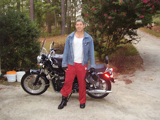
I included a picture of my bike and me. I just put a back rest on it. I need that to support a large travel bag I've bought for the trip. The back rest cost me 400 dollars installed, and I still have buyers remorse over that. I'm not sure what they make Triumph back rests out of, but I suspect there's some precious metals involved.


Wednesday, September 26, 2007

The Big Idea

About a year after I purchased my home in Cumming Georgia I became interested in the history of the forced removal of the Cherokee Indians from Georgia.

I think what initially sparked my interest was that you can live here in northern Georgia and be oblivious to the fact that the Cherokee people were ever here. In fact, you can know about something called the Trail of Tears and not realize that it may have started in your back yard.

There are very, very few markers.

There's a beautiful park near my house with a stream running through it. The stream flows swiftly over and around an incredible rocky shoal area where swimmers and sun bathers can lounge on large gray water smoothed boulders. Over the stream spans an old woodened covered bridge that the people of the area are rightly proud of.

The bridge is the centerpiece of the park. Most people who live here believe it is the bridge that makes the park significant. Most people either do not read the historical marker in the park or chose not to understand the significance of what it says.

The marker says that the park, called Pooles Mill Park, was once the site of a mill owned by Cherokee Chief George Welch. It goes on to say the mill passed to Jacob Scudder when Chief Welch was divested of the property when the Cherokee were removed from North Georgia and sent on the Trail of Tears.

I remember when I first read that plaque it took a few minutes for me to reconcile in my mind that Indians owned mills; let alone the fact that a mill could be taken away from someone simply because he was part Indian (Welch is hardly a Cherokee name). Weren't Indians savages that lived in tents sewn from buffalo hides.

Now, I had heard of the Trail of Tears before I had moved to Georgia, but I had always assumed it was out west somewhere. All I knew about Indians I had learned from movies - Suffice to say I knew nothing. I was shocked to read this plaque in what is basically my back yard and realize how much history had occurred around my new home, and I was struck by how little evidence remained of this history.

It seemed to me it was like living in Gettysburg and never knowing there was a battle fought there. Of course, that's absurd. Everyone knows what happened at Gettysburg, and if you do not you surely would know after driving through the town. There are markers, monuments, signs, shops, and tourists everywhere to commemorate what happened there, but there's almost nothing in my back yard that tells anyone what happened here.

Now, as far as numbers go. It is true, that what happened to the Cherokee seems less tragic than what has happened to many other cultures throughout history. For example, the tragedy of black slavery impacted far, far more people than the Cherokee removal. At the time of their removal, the Cherokee numbered fewer than 18,000 in Georgia. Some sources place the number closer to 14,000. And at their height in the 15th century, before they met Destoto and lost half their numbers to small pox, they probably numbered not much more than 35,000.

No matter how you rank the removal of the Cherokee Indians in the list of sad and cruel things man has done to his fellow man, you'd have to agree that it is somewhat odd that you can live on the very land where U.S. soldiers forcibly drove over 13,000 men, women, and children from their homes, herded them into stockades, starved and beat them, then marched them 1000 miles north west on a brutal trek where over a third of them died, and not know it may have happened on the very ground where your house now stands.

I can not get this thought out of my head. Even now, nearly 8 years after I moved into the area, I still bore co-workers with my rants about the amazing forgotten story of the Indian removal. In my obsession with the subject, I've developed the idea for a novel that has as it's back drop the story of the Cherokee removal. Before I can write the story, however, I need to understand a little more about where the Cherokee went and what their life is like now.

I need to go to Oklahoma.

I've decided I will go alone, and I will get there, and back, on my little Triumph Bonneville motorcycle. Also, as a form commemoration and to satisfy my curiosity, I plan on following the northern land route of the Trail of Tears out. I'll take a more direct route home.

My plan is to depart Cumming Georgia on Sunday October 7th and return the following Saturday.

I will use this blog to chronicle the trip from preparation and departure to return.